
Toyota’s research division has announced plans to use satellite imagery to create automated high-definition maps for its autonomous vehicles.
The proof of concept will see Toyota Research Institute-Advanced Development (TRI-AD) collaborate with IT services provider NTT DATA UK and space tech firm Maxar Technologies Inc.
Go deeper with GlobalData

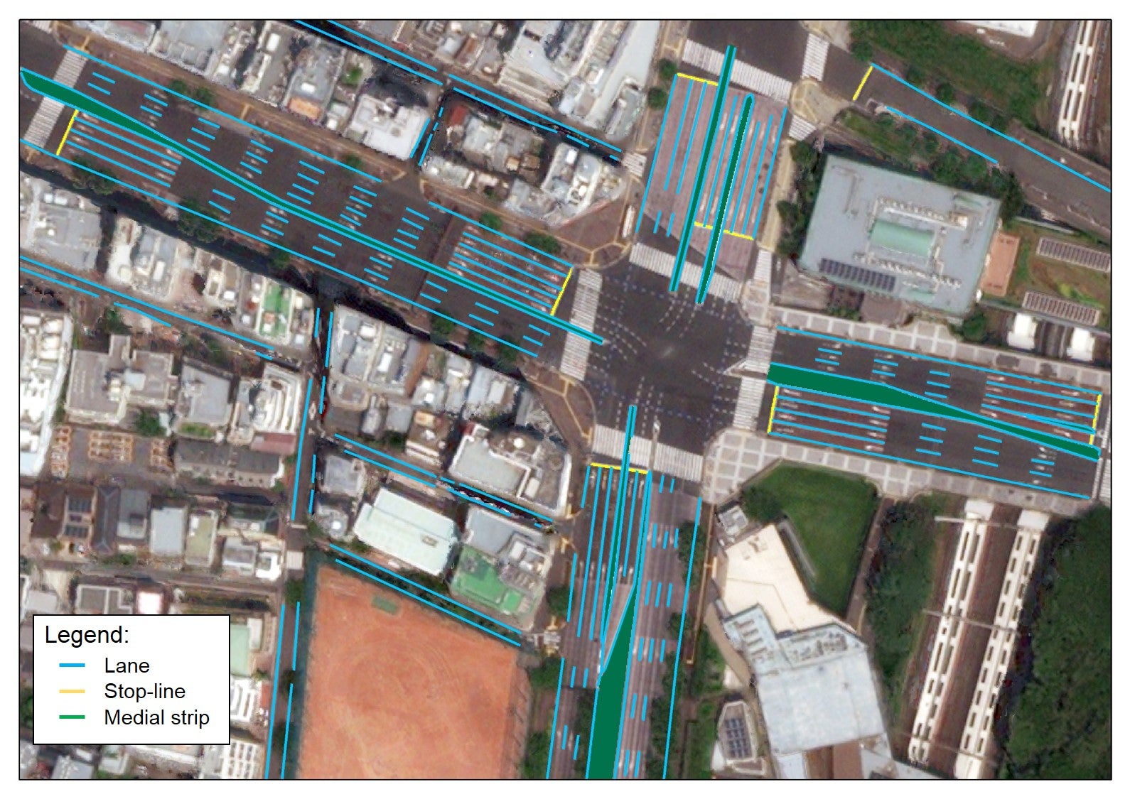
Autonomous vehicles depend on a range of real-time sensors, such as LiDAR, radar and cameras, to navigate. These must be cross-referenced with accurate HD maps to ensure safety on the roads.
While most GPS is accurate to within a few metres, HD maps are accurate at the centimetre level.
To create the HD road maps, Maxar will provide images from its library of optical satellite imagery. Using Maxar’s cloud-based Geospatial Big Data platform, the data will be fed into NTT DATA’s algorithms, which will determine what is relevant, using artificial intelligence (AI) to generate the map itself.
TRI-AD will then make the maps available in its self-driving Toyota test vehicles, with the project an “important move” in furthering its open software platform concept, Automated Mapping Platform (AMP).
How well do you really know your competitors?
Access the most comprehensive Company Profiles on the market, powered by GlobalData. Save hours of research. Gain competitive edge.

Thank you!
Your download email will arrive shortly
Not ready to buy yet? Download a free sample
We are confident about the unique quality of our Company Profiles. However, we want you to make the most beneficial decision for your business, so we offer a free sample that you can download by submitting the below form
By GlobalDataAutonomous vehicle HD maps: one part of the AV puzzle
The Japanese car maker joined forces with investment giant SoftBank last October to accelerate the development of its driverless cars. TRI-AD has also been partnered with chipmaker NVIDIA for the past three years to help develop and train its autonomous vehicles.
The HD mapping will initially be for the Tokyo metropolitan region, but with the goal of expanding globally.
“Recent advances in electronics and aerospace engineering are leading to higher resolutions and more frequent updates of global imagery from space-based assets,” said Mandali Khalesi, vice president automated driving at TRI-AD.
“Additionally, machine learning is helping automate the discovery and integration of semantic relationships between road elements within image data. We’re excited to collaborate with Maxar and NTT DATA to revolutionise automated driving mobility for all.”
HD map companies meet autonomous vehicle demand
According to TRI-AD analysis, HD maps cover less than 1% of the global road network. The lack of HD maps, combined with a growing autonomous vehicle market, has created an opportunity for a number of HD mapping firms such as Carmera (also partnered with TRI-AD), Civil Maps and Mapillary.
Katsuichi Sonoda, vice president and head of NTT DATA’s Social Infrastructure Solution Sector, said: “We have been fully engaged in the satellite-imaging business for 20 years, providing our AW3D-branded 3D maps on a global short-delivery basis.
“In this new project, we will use NTT DATA’s AI and enhanced image-processing expertise to expand the coverage of high-definition maps on a fast, scalable and cost-effective basis. In the future, we hope to map worldwide road networks from space using our enhanced image-processing expertise.”
Maxar vice president of Global Sales added that autonomous vehicle HD maps are “an essential element for the navigation and safety of autonomous vehicles, and Maxar is proud to provide the data and analytics platform that makes HD maps possible”.
“This new, innovative project points to the growing demand of our exclusive high-resolution imagery and geospatial analytics.”
Read more: Mapping our oceans: how satellites power the world’s shipping lanes