The World Wide Fund for Nature (WWF) has teamed up with satellite telecommunications company Inmarsat to develop a technological solution to help keep better records of incidents of human-wildlife conflict.
The mobile-based satellite communication technology solution will streamline the collection of information of wildlife attacks against people, crop disease, and inter-species disease transmission.
Go deeper with GlobalData


Access deeper industry intelligence
Experience unmatched clarity with a single platform that combines unique data, AI, and human expertise.
With connectivity limited in many rural parts of the world, monitoring of human-wildlife conflict is a laborious task for local populations, and gathering the data to improve the situation can be challenging. However, using Inmarsat’s mobile satellite devices, community volunteers will be able to record incidents with ease.
This information will then be transmitted to the relevant authorities via satellite in real-time, which can then be used to monitor incidents and take action.
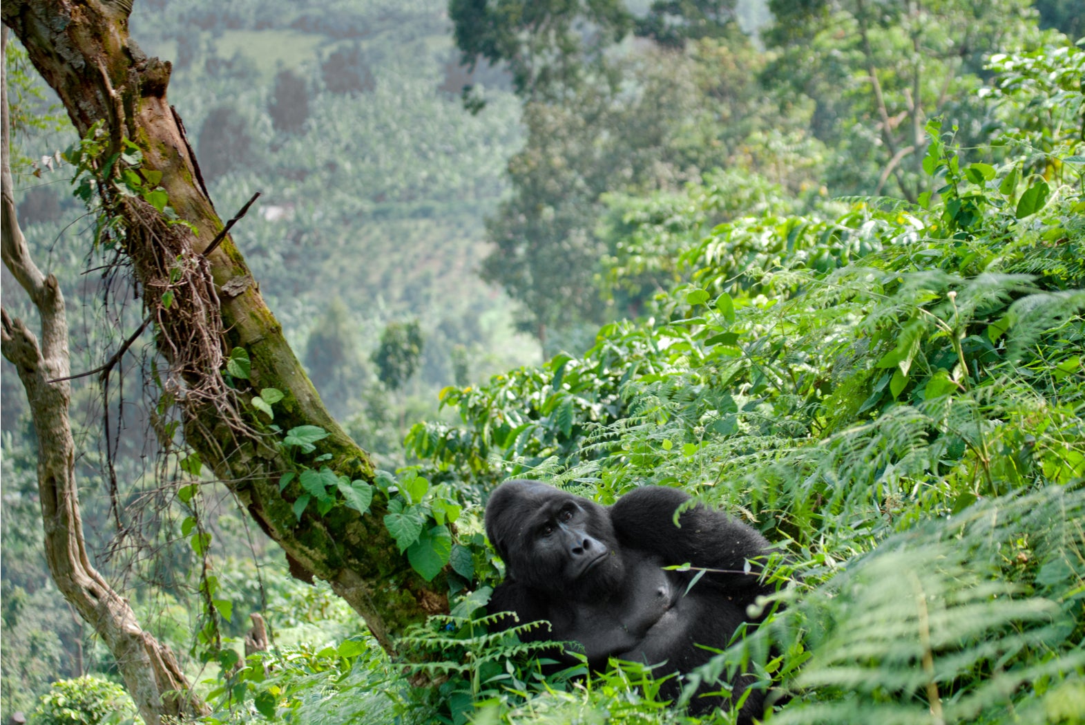
Protecting Uganda’s mountain gorillas
The technology will be tested in the Bwindi Impenetrable National Park in Uganda, where the rapid growth of human populations is reducing wildlife’s access to space and resources.
This is particularly concerning for the 400 mountain gorillas that reside in the park. There are currently around 2,000 mountain gorillas in the world, with the sub-species classed as endangered by the WWF.
The technology will be used by local members of the Human Gorilla Conflict Resolution programme, which was established by the Ugandan Wildlife Association following an increase of attacks on crops, people and wildlife by mountain gorillas in the region.
It is hoped that the initiative, a collaborative effort between WWF and Fauna & Flora through their International Gorilla Conservation Programme (IGCP), will provide better insight into how human populations, mountain gorillas and other wildlife can continue to co-exist.
“Finding solutions that enable the coexistence of wildlife and local communities is the only way that conservation efforts can succeed,” said Cath Lawson, WWF’s regional manager for Africa.
“The technology solutions we’re piloting in this project have the potential to transform data collection processes which enable better informed management decisions for both people and mountain gorillas.”
Paul Gudonis, president at Inmarsat Enterprise, said:
“We are delighted to be working with the WWF, IGCP and Ugandan Government and community groups to decrease human-gorilla conflict in the region. We are excited at the potential of using our BGAN satellite connectivity and our IoT expertise to deliver innovative new solutions to conservation projects throughout sub-Saharan Africa.”
Technology is providing new solutions in the fight to conserve endangered species. A previous collaboration between the WWF, Liverpool John Moores University and the Hutan Kinabatangan Orangutan Conservation Program used thermal imaging cameras attached to drones to monitor the number of orangutans in the world.
Read more: Forest conservation: How drones can help save our forests from climate change